

Overview
The canyon in brief
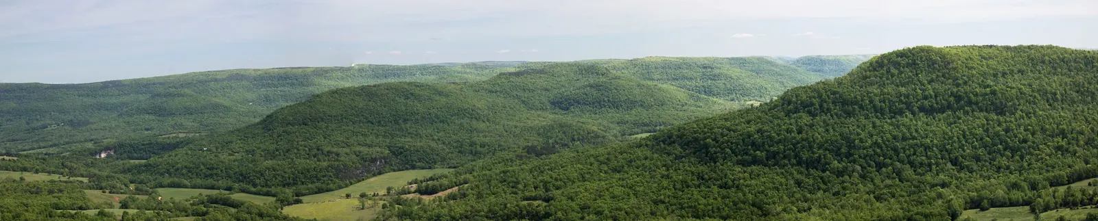
The Arkansas Grand Canyon is a tourism name for the wide valley landscape seen from Scenic Highway 7 about six miles south of Jasper in Newton County, Arkansas 2,3. The view opens across the western Big Creek drainage in the Boston Mountains, the southern portion of the Ozark Plateau 4,5,6. It is a stretch of roadside views rather than a single formally bounded canyon park, with the Cliff House Inn, Scenic Point and an ARDOT-promoted stop serving as distinct locations 2,3,7,8,9.
What is the Arkansas Grand Canyon?
From the Cliff House Inn, the best-known vantage point, the view runs roughly east toward Vendor, about 4.8 miles away in a straight line 2,4,10. Ridges, cliffs, stepped slopes and hollows reflect the different ways sandstone, shale and limestone respond to erosion 6,11. The surrounding landscape belongs to the Boston Mountains, which the Encyclopedia of Arkansas describes as having the greatest valley-to-summit relief of any formation between the Appalachians and the Rockies 6.
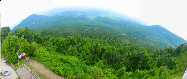

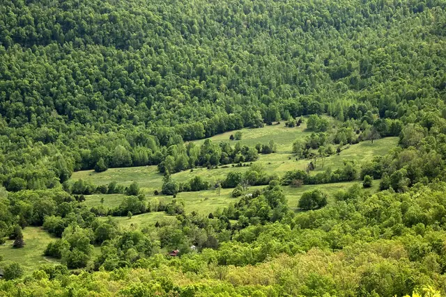
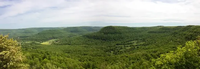
The water below the inn is not the Buffalo River or the Little Buffalo River 4,5,12. It drains through Dry Branch into the Left Fork of Big Creek, then into Big Creek, which flows north past Mount Judea and reaches the Buffalo River near Carver 4,5,12,13. The Little Buffalo occupies a separate valley to the west and northwest 4. Understanding that distinction makes the Big Creek and Buffalo River watershed easier to read in the landscape.
Named features in and around the view include Rocklick Point, Morgan Point, Asia Point, Judea Mountain, Ricketts Mountain and Riddle Point; several are cliffs rather than summits 10,14. Vendor lies to the east, Mount Judea to the east-southeast and Red Rock to the southeast, but the visibility of individual features from each viewpoint has not been field-checked 10,14.
The landscape also appears in tourism material as “Arkansas' Grand Canyon” and “Grand Canyon of the Ozarks,” while older accounts use Vendor Valley or Big Creek Valley 3,7,15,16,17. According to Bill Bowden's 2020 Arkansas Democrat-Gazette account, inn operators Jane and Chris McNutt promoted the canyon name in the early 1970s 15,18. The inn's published ownership history suggests an earlier McNutt tenure, leaving the exact year and first use unresolved 19. The history of the name separates those retrospective accounts from dated evidence.
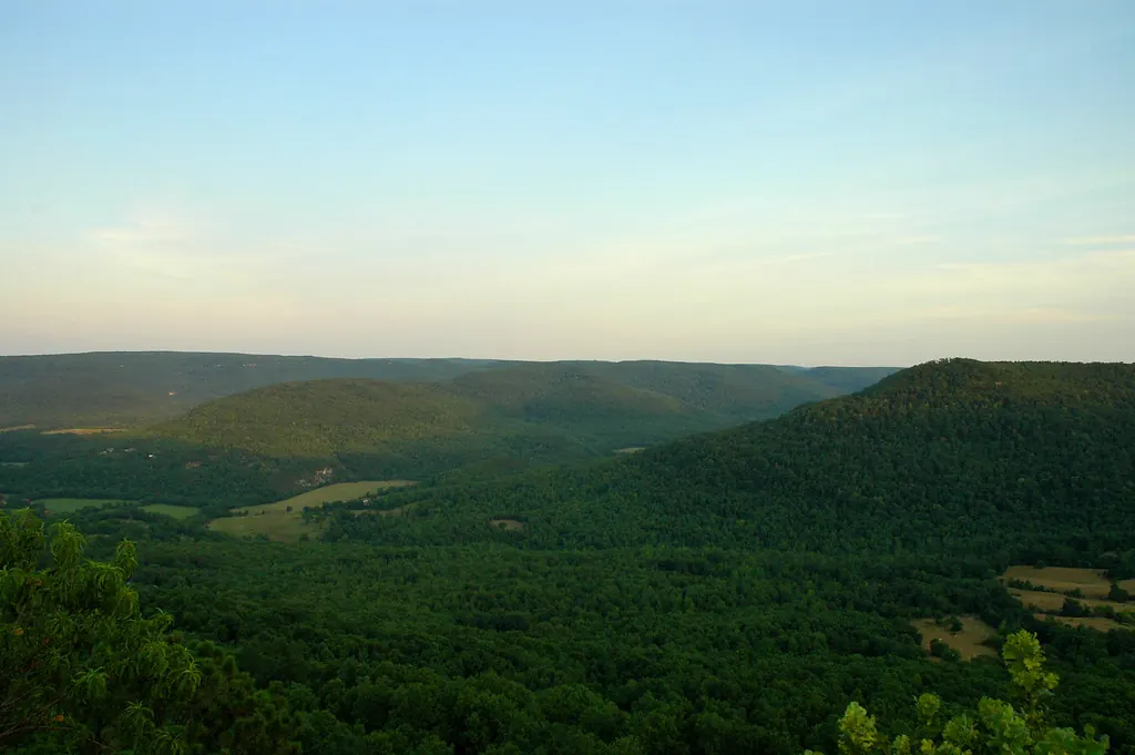
Is it a real canyon?
The valley is real, and streams carved it through layered rock over a very long time 6,11,20,21. “Arkansas Grand Canyon” is a tourism nickname, not an official USGS geographic name, and it has no defined boundary or officially published maximum depth 22,23,24,25,26,27. The Boston Mountains are a dissected plateau, not a folded mountain range, and the valley is not a fault-created rift or a collapsed cave 6,11,20,21. Read the geology of the Arkansas Grand Canyon for the difference between the age of its rocks and the later erosion of its valleys.
Quick facts
| Question | Answer |
|---|---|
| Where is it? | Along Scenic Highway 7, about six miles south of Jasper, Newton County, Arkansas 2,3. |
| What mountain region is this? | The Boston Mountains, in the southern Ozark Plateau 6. |
| What water drains the valley? | Dry Branch, the Left Fork of Big Creek and Big Creek, within the Buffalo River watershed 4,5,12. |
| How did the valley form? | Streams eroded layered sandstone, shale and limestone 6,11,20,21. |
| How high is the Cliff House viewpoint? | About 1,960 feet, estimated from a USGS terrain model rather than a surveyed benchmark 25,28. |
| How deep is the view? | Roughly 1,000 to 1,100 feet to sampled valley-bottom points, not an official maximum 25,26,27. |
| Is the name official? | None of the three canyon name forms appears in the USGS place-name files updated November 2, 2026 22,23,24. |
| What is the scenic road? | Highway 7, Arkansas's first designated state scenic byway, established in 1993 29,30. |
| What protected river is nearby? | Buffalo National River, established in 1972 as the first national river in the United States 31,32. |
Why the canyon matters today
Scenic Highway 7 connected Newton County to visitors and new roadside businesses when paving crossed the county in the 1950s 33,34. Its state scenic-byway designation began in 1993, and ARDOT included the canyon in its Explore AR Highways campaign launched October 12, 2026 7,8,30. The view remains part of the road's tourism story, not simply an isolated overlook 3,7,8.
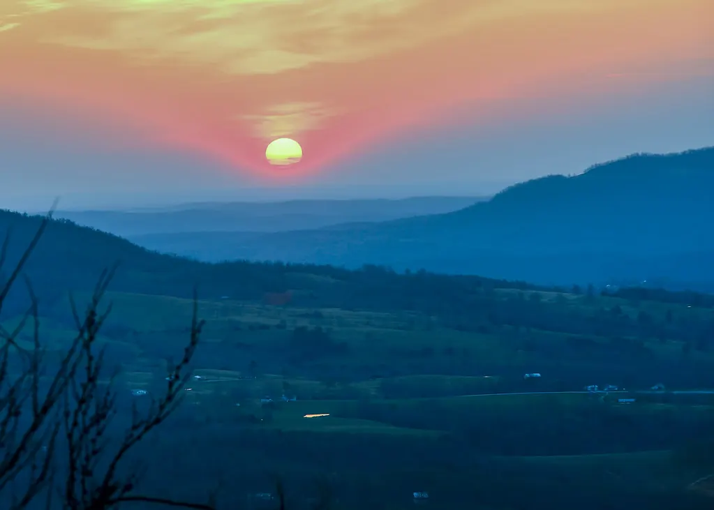
The valley's connection to the Buffalo watershed gives it a conservation significance beyond the view 4,5,12. Buffalo National River protects 135 miles of free-flowing river, while Big Creek's limestone terrain allows water to move through underground pathways 21,31,32,35. The state's 2026 assessment lists continuing water-quality impairments in Big Creek and the Left Fork, with bacterial sources not specifically identified 36. Buffalo National River became an International Dark Sky Park in 2019; that designation covers the park, not the Highway 7 overlook 37.
Planning a visit
Start with the visitor guide to distinguish the roadside viewpoints and plan your approach. Then compare things to do and off-roading options; off-road driving is not allowed inside Buffalo National River 38,39.
For an overnight stay, the lodging guide includes options such as the Cliff House Inn, Arkansas Grand Canyon View Cabins and Bearly Earth Retreat, a whole-property cabin rental between Jasper and Pelsor 40,41,42,43. Use the food and shops guide to plan stops around Jasper, where listings include the Ozark Cafe, Jasper Pizza Company and Peggy Sue's Coffee 44,45,46. Confirm business details before setting out.
The chapters
The contents are drawn as a geologic column. Each band is named for a real rock formation exposed in the canyon walls, youngest at the top, the same order you would pass them walking down from the rim. Read more in How the Arkansas Grand Canyon Formed.
The Canyon
Bloyd Formation Lower Pennsylvanian
- How the Arkansas Grand Canyon FormedRead the landscape through its rock layers, stream erosion and karst. Understand what the published elevation and depth figures measure.
- Where the Name “Arkansas Grand Canyon” Came FromFollow the canyon's changing names and the attributed McNutt promotion story, with a clear account of the conflicting dates and unanswered questions.
- Big Creek and the Buffalo National RiverHow the canyon's streams reach the Buffalo, why the river was protected, and what monitoring shows about Big Creek's water quality.
History
Pitkin Limestone Mississippian
- The First People of the Arkansas Grand Canyon RegionExplore the regional archaeological record and Osage and Western Cherokee history. Learn why the lost “bluff dweller” story is wrong.
- Vendor, Mount Judea and Deer Settlement HistoryFollow the communities around the canyon through county founding, farm life, the Civil War, timber work and the arrival of electricity.
- Scenic Highway 7 and Arkansas's First Scenic BywayThe road's development, staged paving, roadside attractions and 1993 scenic designation, with a guide to the canyon drive today.
- The Cliff House Inn on the Arkansas Grand Canyon RimThe inn's founding, changing owners, tornado recovery and house pie, with carefully dated information about dining and lodging.
Visiting
Fayetteville Shale Mississippian
- Visiting the Arkansas Grand CanyonLocate the Highway 7 viewpoints, choose a season and prepare for a responsible visit to the canyon and nearby Buffalo National River.
- Things to Do near the Arkansas Grand CanyonViewpoints, trails, river access and local history, organized by road estimates, straight-line distances and places without an established distance.
- Wildlife, Fog and Seasons at the Arkansas Grand CanyonA field guide to the canyon's forests and fog, regional wildlife, seasonal color, night skies and weather precautions.
- Off-Roading near the Arkansas Grand CanyonA guide to J3 at the Gap, private riding options, National Forest routes and the limits of Arkansas's UTV road law.
- Where to Stay near the Arkansas Grand CanyonA lodging directory with a disclosed featured stay, other cabins and inns, river campgrounds and clearly labeled distance estimates.
- Food, Shops and Outfitters near the Arkansas Grand CanyonA place-based directory of meals, coffee, gifts, general stores and river services, with unverified hours and closures clearly marked.
Reference
Boone Formation Mississippian
- Arkansas Grand Canyon TimelineA dated reference to the region's Native history, communities, road building, tourism and Buffalo River conservation.
- Arkansas Grand Canyon Myths and FactsClear answers to common questions about the canyon's dimensions, name, rivers, history and nearby destinations.
- Photos of the Arkansas Grand Canyon AreaEvery photo on this site in one place, grouped by chapter, with the photographer, license and source for each.
- Sources and Further ReadingThe full numbered list of sources behind every page, with the pages that cite each one.
- About This EncyclopediaOur sources, evidence labels, photo credits, open historical questions and ownership disclosure.
Sources for this page
Numbers in the text match this list. Bracketed numbers link to the complete source list. Accessed on or before November 3, 2026.
- ksblack99, "Arkansas Grand Canyon Panorama," Flickr (Public Domain Mark 1.0) www.flickr.com/photos/ksblack99/34607999310/ [243]
- Cliff House Inn: Published coordinates and directions cliffhouseinnar.com/contact/ [1]
- Arkansas Tourism, Arkansas Scenic 7 Byway www.arkansas.com/experiences/discover/attraction-listings/arkansas-sceni… [2]
- USGS National Hydrography Dataset: Large-scale flowlines hydro.nationalmap.gov/arcgis/rest/services/nhd/MapServer/6 [10]
- USGS: Big Creek seepage and dye-tracing data release www.usgs.gov/data/seepage-investigation-and-dye-tracing-characterize-bas… [11]
- Encyclopedia of Arkansas, "Boston Mountains" (Margaret J. Guccione) encyclopediaofarkansas.net/entries/boston-mountains-2389/ [13]
- ARDOT, Explore AR Highways www.ardot.gov/explore/ [6]
- ARDOT Launches Public Interactive Quest: Explore AR Highways, October 12, 2026 ardot.gov/news/26-166/ [25]
- Scenic Point Gift Shop chamber listing newtoncountychamber.com/directory/scenic-point-gift-shop/ [189]
- USGS GNIS: Vendor, Mount Judea, and Red Rock carto.nationalmap.gov/arcgis/rest/services/geonames/MapServer/3/query?f=… [26]
- Arkansas Archeological Survey: Geology of Ozark bluff shelters archeology.uark.edu/ozarkbluffshelters/basics/geology/ [16]
- USGS GNIS: Big Creek, Left Fork, and both Dry Branch records carto.nationalmap.gov/arcgis/rest/services/geonames/MapServer/6/query?f=… [12]
- University of Arkansas: Sokolosky thesis on Big Creek geochemistry, 2019 scholarworks.uark.edu/cgi/viewcontent.cgi?article=4950&context=etd [27]
- USGS GNIS: Named cliffs, Judea Mountain, Ricketts Mountain, and Riddle Point carto.nationalmap.gov/arcgis/rest/services/geonames/MapServer/5/query?f=… [28]
- Bill Bowden, State’s Grand Canyon still a draw, February 3, 2020, PressReader edition www.pressreader.com/usa/arkansas-democrat-gazette/20200203/2817412714065… [3]
- John Robinette, Jasper, Arkansas Shamrock Tour, RoadRUNNER, September/October 2024 www.roadrunner.travel/tours/jasper-arkansas-shamrock-tour/ [4]
- Arkansas Tourism, 5 Reasons to Explore Jasper on Your Next Weekend Getaway www.arkansas.com/plan-your-trip/plan/trip-ideas-itineraries/5-reasons-to… [5]
- Bill Bowden, Arkansas’ Grand Canyon still a draw, Arkansas Democrat-Gazette www.arkansasonline.com/news/2020/feb/03/state-s-grand-canyon-still-a-dra… [34]
- History of the Cliff House Inn cliffhouseinnar.com/about/ [35]
- Arkansas Geological Commission: Parthenon geological map geology.arkansas.gov/docs/pdf/maps-and-data/geologic_maps/24k/Parthenon.… [14]
- Arkansas Geological Survey: Mount Judea geological map, revised 2015 geology.arkansas.gov/docs/pdf/maps-and-data/geologic_maps/24k/Mount%20Ju… [15]
- USGS, Download GNIS Data www.usgs.gov/us-board-on-geographic-names/download-gnis-data [7]
- USGS Arkansas DomesticNames extract, modified November 2, 2026 prd-tnm.s3.amazonaws.com/StagedProducts/GeographicNames/DomesticNames/Do… [8]
- USGS national AllNames official and variant-name extract, modified November 2, 2026 prd-tnm.s3.amazonaws.com/StagedProducts/GeographicNames/Topical/AllNames… [9]
- USGS terrain-elevation estimate at the published Cliff House coordinate epqs.nationalmap.gov/v1/json?x=-93.16241&y=35.94536&units=Feet&wkid=4326… [17]
- USGS terrain-elevation estimate at a selected western Dry Branch point epqs.nationalmap.gov/v1/json?x=-93.13870061544743&y=35.94531851077521&un… [19]
- USGS terrain-elevation estimate at the Dry Branch near Vendor station coordinate epqs.nationalmap.gov/v1/json?x=-93.1129529&y=35.93341086&units=Feet&wkid… [20]
- USGS: Accuracy and limitations of elevation point queries www.usgs.gov/faqs/how-accurate-are-elevations-generated-elevation-point-… [18]
- CALS: Arkansas Highway 7 encyclopediaofarkansas.net/entries/arkansas-highway-7-14001/ [21]
- ARDOT: Scenic Byways ardot.gov/divisions/right-of-way/row_sections/beautification-section/sce… [22]
- Public Law 92-237, March 1, 1972 www.congress.gov/92/statute/STATUTE-86/STATUTE-86-Pg44.pdf [23]
- CALS Encyclopedia of Arkansas: Buffalo National River encyclopediaofarkansas.net/entries/buffalo-national-river-7/ [24]
- Shiloh Museum: Scenes of Newton County shilohmuseum.org/project/scenes-of-newton-county/ [74]
- AHPP: Jasper Commercial Historic District tour script, April 12, 2014 www.arkansasheritage.com/docs/default-source/ahpp-documents/sandwiching-… [64]
- Murdoch, Bitting, and Van Brahana: Boone karst hydrogeology in Big Creek Valley, 2016 link.springer.com/article/10.1007/s12665-016-5981-y [30]
- Arkansas DEQ: 2026 Integrated Water Quality Monitoring and Assessment Report adeq.state.ar.us/water/planning/integrated/303d/pdfs/2026/2026%20305%28b… [112]
- NPS: Night Sky Viewing www.nps.gov/buff/planyourvisit/night-sky-viewing.htm [133]
- Polaris Adventures Compton rental listing adventures.polaris.com/adventure/off-road-rentals-compton-arkansas-P-QB2… [175]
- Buffalo River Off-Road Rentals services www.bransonoffroadrentals.com/buffalo-river [176]
- The Cliff House Inn Lodging cliffhouseinnar.com/inn/ [148]
- Arkansas Grand Canyon View Cabins homepage www.arkansasgrandcanyonviewcabins.com/ [213]
- Arkansas Grand Canyon View Cabins directions www.arkansasgrandcanyonviewcabins.com/location/ [214]
- Bearly Earth Retreat official website and approximate distances bearlyearth.com [177]
- Ozark Cafe chamber listing newtoncountychamber.com/directory/ozark-cafe/ [215]
- Jasper Pizza Company chamber listing newtoncountychamber.com/directory/jasper-pizza-company/ [216]
- Peggy Sue's Coffee official website www.peggysuescoffee.com/ [217]